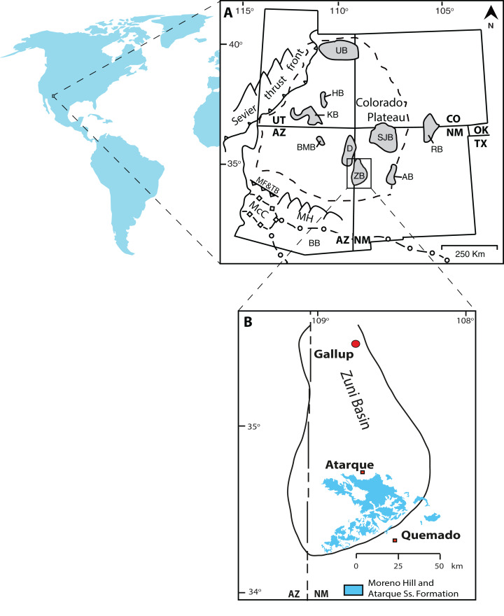
Figure 1. Location map.
(A) Map of Colorado Plateau and adjacent areas (modified from Molenaar (1983a), Dickinson et al. (2012), Pecha et al. (2018)); (B) Map of the Zuni Basin and exposure of the Atarque Sandstone and Moreno Hill Formation (modified after Trumbull (1960), McLellan et al. (1983b), New Mexico Bureau of Geology & Mineral Resources (2003), and references therein). Note: UB, Uinta Basin; HB, Henry Basin; KB, Kaiparowits Basin; RB, Raton Basin; SJB, San Juan Basin; BMB, Black Mesa Basin; ZB, Zuni Basin; AB, Acoma Basin; McC, McCoy Basin; BB, Bisbee Basin; D, Defiance Uplift; MH, Mogollon Highlands; MF&TB, Maria Fold and Thrust Belt.

