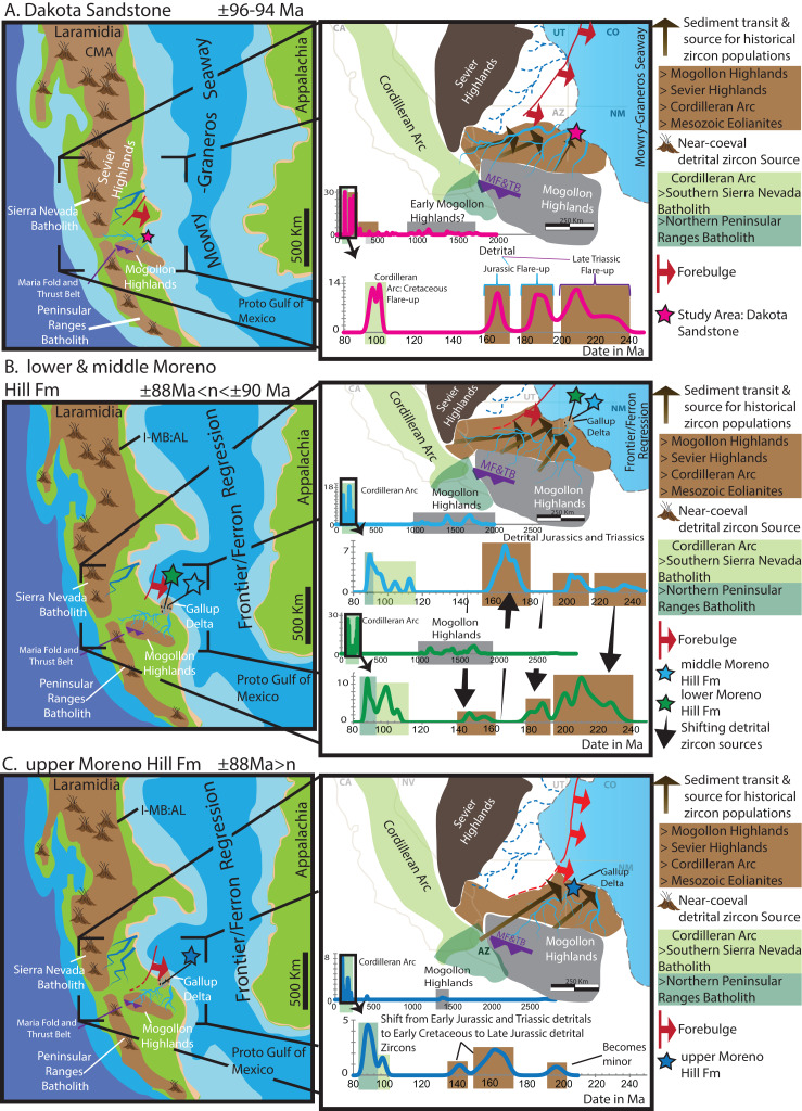
Figure 9. Reconstruction of the Moreno Hill depo-center.
(A) Emplacement of the alluvial Dakota Sandstone after 96 Ma during the Mowry–Graneros Seaway with sediment transported via northeasterly draining fluvial systems. (B) Emplacement of sediment in the lower and middle Moreno Hill Formation, with youthful detrital zircons from the Cordilleran Arc accompanied by sediment and historical zircon populations from the Mogollon Highlands, along with surrounding (reworked) sedimentary blanket southeast of the Sevier Highlands and north of the Mogollon Highlands into the Gallup Delta. (C) Emplacement of sediment into the upper Moreno Hill depo-center with similar source terranes to the underlying units; yet, with the eastward migrating forebulge it is less likely the Sevier and its eastwardly adjacent sedimentary blanket to be a prominent source (now within the north-trending foredeep). Geophysical/paleogeographic maps are based on a synthesis of sources, namely Blakey (2014), Pecha et al. (2018), Lin, Bhattacharya & Stockford (2019), Miall & Catuneanu (2019), Tucker et al. (2020) and references therein.

