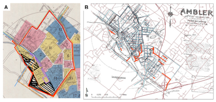
Figure 1.
Historic Maps of Ambler, PA (A) 1930 Sanborn Fire Insurance Map including Riskscape, asbestos manufacturing, and waste sites superimposed on Sanborn Fire Insurance Map; This map depicts the riskscape enclosed in red, Ambler Borough (white lines), Whitpain Township (blue lines), Upper Dublin (light orange), and Lower Gwynedd (green). The asbestos manufacturing buildings (purple) and waste site areas (black) are also shown. (B) Streets that no longer exist in 2016 (indicated in Red), on 1930 Sanborn Fire Insurance map and surrounds.

