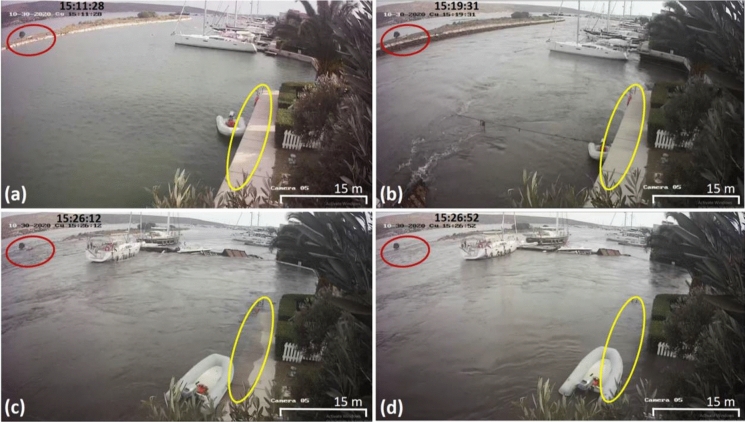
Fig. 21.
Security video frames showing different stages of the tsunami motion in the Port Alaçatı houses, Alaçatı, Fig. 3a (38.2592° N, 26.3797° E). Timestamps are in local time (GMT + 03:00), and the earthquake time is 14:51:23 (AFAD 2020). a No water motion 10 min after the earthquake, b maximum water withdrawal (~ 1.50 m), the white boat started to move from its original location, c start of inundation, the white and adjacent boats, and the small berthing structures were moved and damaged, and d maximum water level increase (~ 1.70 m) and inundation in the region. Red and yellow ellipses show water level changes at specific locations, around the small tree over the middle breakwater and quay floor, respectively

