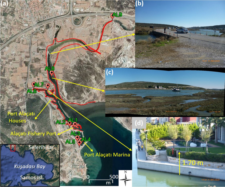
Fig. 3.
a Map showing the surveyed locations in Alaçatı locality (image is
taken from Google Earth) The red line shows the tsunami penetration/inundation zone. b Tsunami traces visible on Alaçatı Azmak bridge (at ~ 30 cm above the bottom of the bridge wall) located 1.0 km away from the coastline (38.2706° N, 26.3768° E), c Fisher boat dragged 1160 m away from the fishery port along Alaçatı Azmak, d Water level increase at the garden wall of Alaçatı Port houses according to the house owner

