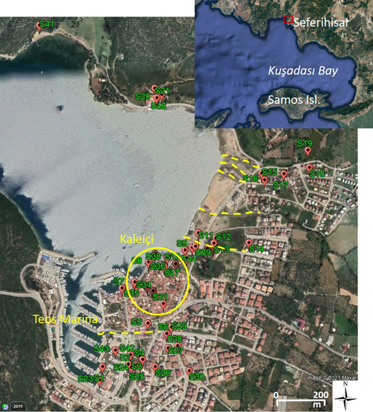
Fig. 8.
General view of the surveyed locations in Sığacık. Dashed yellow lines show the local river/riverbeds where the tsunami penetrated. Teos Marina and Kaleiçi regions experienced heavy damage. There was significant inundation in the most low-lying area (~ 410 m) due to an incoming wave through the bay (Table 2-S19) as well as through Teos Marina (Table 2-S30) (image is
taken from Google Earth)

