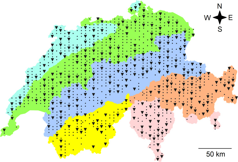
FIGURE 1.
Map of Switzerland with the locations of the 255 sites, where soil bacterial communities were sampled (triangles) and of all the other 903 sites (dots) of the soil sampling campaign of the Swiss Biodiversity Monitoring (BDM). Colors represent biogeographic regions (BGR; from North to South): the Jura Mountains (light blue), the Central Plateau (green), the Northern Alps (dark blue), the Eastern (orange), and Western (yellow) Central Alps representing the central ridge of the Alps as well as the Southern Alps (rose). The entire country includes an area of 41,285 km2 and the extension of the sampling area was 222 km from North to South and 343 km from West to East. Data for the map were retrieved from Federal Office for the Environment (2001).

