
Fig. 3.
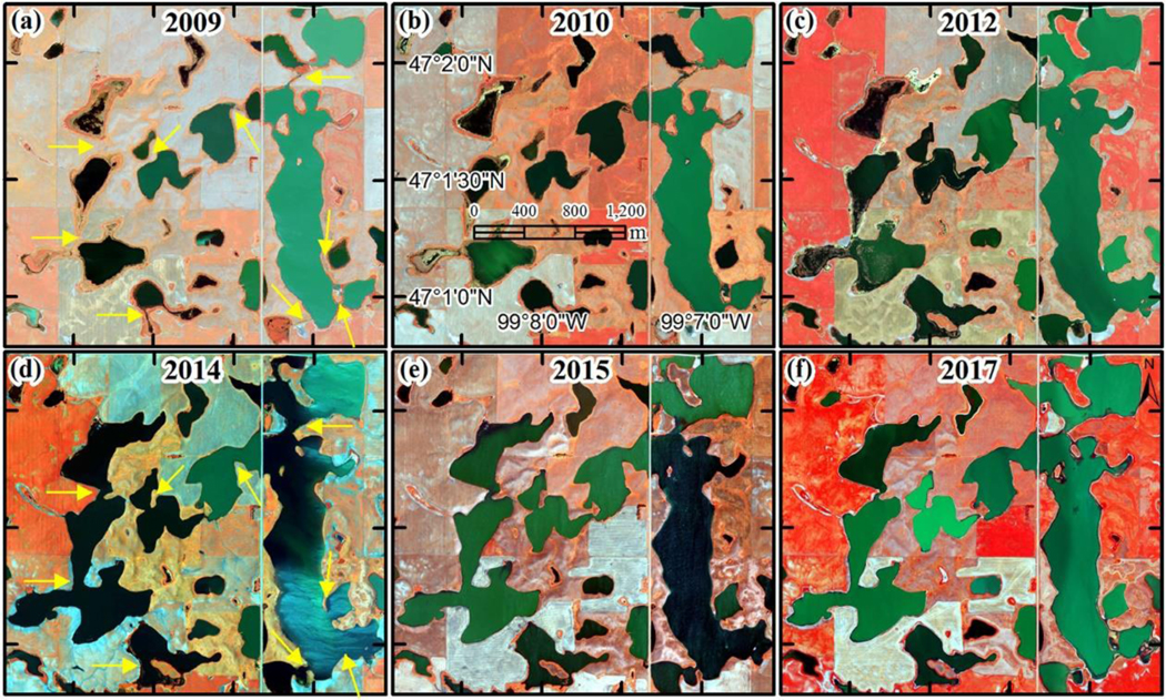
Multi-temporal NAIP aerial images (2009–2017), illustrating dynamic changes in wetland inundation extent resulting from fill-merge-spill hydrological processes in the Prairie Pothole Region. Each image is a false-color composite using the band combination of near-infrared (N), red (R), and green (G). The yellow arrows in (a) and (d) are pointing at locations where wetland merging occurred.