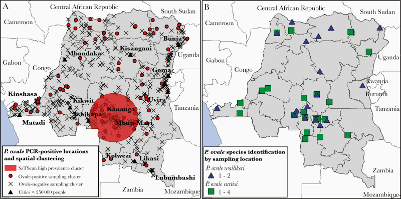
Figure 2.
A, Spatial clustering of ovale malaria infections detected by SaTScan. Large cities with a population estimate of greater than 250 000 in 2000 and Demographic and Health Survey sampling cluster locations are included for reference. Sample clusters represented by a closed circle indicate the presence of 1 or more individuals positive for Plasmodium ovale, clusters represented with an “X” indicate that no P. ovale was detected. B, Sampling locations corresponding to P. ovale curtisi and P. ovale wallikeri-positive samples. For 12 samples across 5 provinces, global positioning system (GPS) sampling cluster coordinates were missing; these samples were plotted at the centroid coordinates of their respective province.

