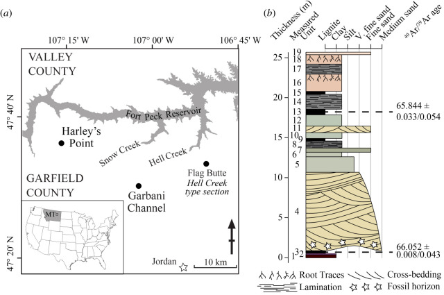
Figure 1.
(a) Location map showing the study area in northeastern Montana, USA. Fort Peck Reservoir is shown in grey. Circles show locations of localities discussed here including Harley's Point and Garbani Channel. The location of the Hell Creek type section, Flag Butte, is also shown. (b) Stratigraphy of a composite section compiled from the most proximal outcrops to Harley's Point locality (shown in electronic supplementary material, figure S1b). Ages shown were determined in [26], for details see the electronic supplementary material.

