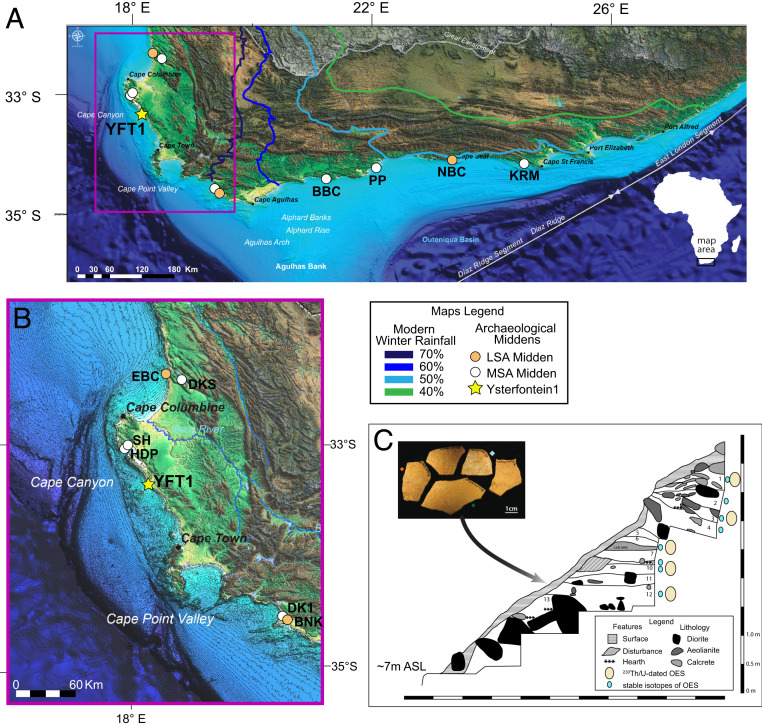
Fig. 1.
YFT1 site location, locations of other sites with marine shell-rich layers, and YFT1 site stratigraphy. (A) Distribution of shell middens along the coasts of South Africa, with modern winter seasonal rainfall isopleths; (B, Inset) detailed map (A, pink outline) of shell middens on the western coast in the winter rainfall zone. Maps in A and B are modified from ref. 83. (C) YFT1 composite stratigraphy, numbered LG, and placement of OES dated by 230Th/U burial dating and/or with stable isotope data, after ref. 12; Inset are the OES sampled from LG12 for stable isotopes and 230Th/U burial dating. Site acronyms for maps A and B are as follows: BBC, Blombos Cave; BNK, Byneskranskop Cave; DK1, Die Kelders 1; DKS, Diepkloof Shelter; EBC, Elands Bay Cave; HDP, Hoedjiespunt; KRM, Klasies River Mouth; NBC, Nelson Bay Cave; PP, Pinnacle Point; SH, Sea Harvest; and YFT1, Ysterfontein 1.

