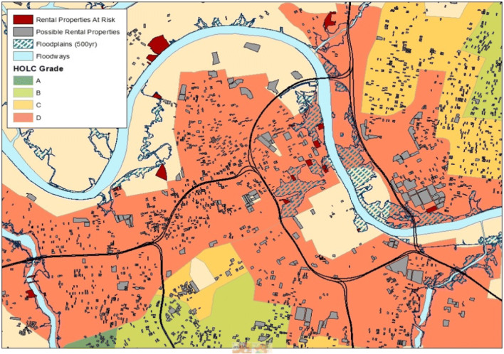
Fig. 3.
“Redlined” areas from early 1940s maps with high-risk flood zones and current rental properties identified. The 1933 Home Owners’ Loan Corporation (HOLC) color-coded map areas based on risk for mortgage lending, often identifying black neighborhoods in “red” (high risk) and making it difficult for homeownership to occur in those areas. Current rental properties are indicated in relation to the old redlined areas. Flood plains are indicated as hatched areas

