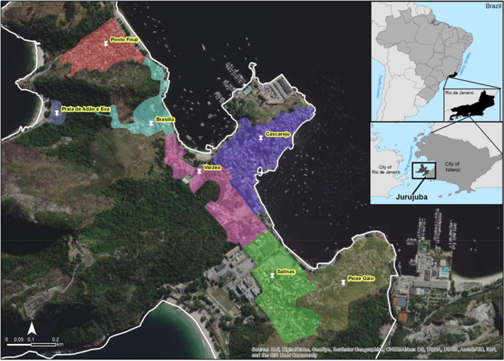
Figure 1.
Map of Jurujuba release areas. Satellite view of Jurujuba, a suburban neighborhood of Niterói (RJ). With an estimated population of 2797 in 2.53 km2, Jurujuba was divided into seven release areas (highlighted) according to local sectors: Ponto Final, Várzea, Brasília, Cascarejo, Praia de Adão e Eva, Peixe-Galo and Salinas. Map was created with ArcGIS Desktop 10.7 (Esri Inc., https://www.esri.com/en-us/arcgis/products/arcgis-desktop/overview) using Google Earth (Google LLC) source code, under the license and in accordance with the fair use described in ‘https://about.google/brand-resource-center/products-and-services/geo-guidelines’.

