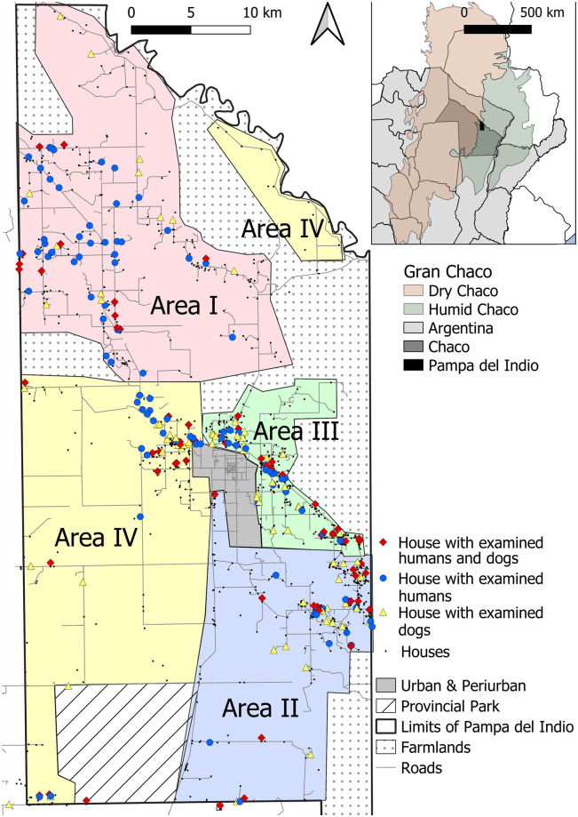
Fig 1. Location of study households included in the human and dog serosurveys.
Operational areas are shown as colored-shaded polygons, 2016–2017. Inset shows the location of Pampa del Indio Municipality within the Chaco Province and the Gran Chaco ecoregion. Maps were based on the data collected within the scope of this study and using base layers from Instituto Geográfico Nacional (Argentina). Available online: https://www.ign.gob.ar/NuestrasActividades/InformacionGeoespacial/CapasSIG.

