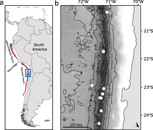
Fig. 1.
a Map of the Peru-Chile Trench defined by depths >4900 m (red). Historical collection records of this species (circle), and the historical abyssal sampling with the absence of Eurythenes atacamensis sp. nov. (triangle). The extent of map (b) is indicated by the blue box. b The eleven deployments where E. atacamensis sp. nov. was recovered in the Atacama Trench during the Atacamex Expedition (square) and the RV Sonne SO216 Expedition (circle). Isobaths are shown every 1000 m between 3000- and 7000-m-depth contours.

