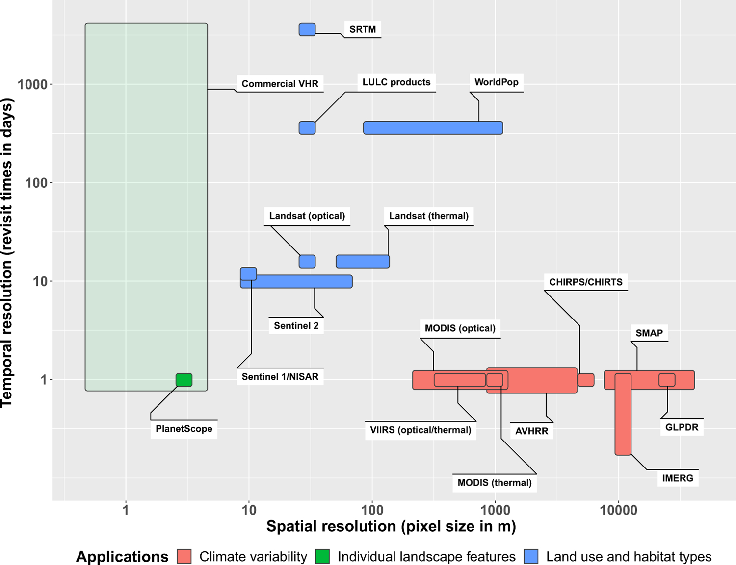
Figure 2. Spatial and Temporal Resolutions of Satellite Missions and Data Products with Applications to Malaria.

Colors represent the main applications of satellite data at different resolutions. The lighter green color of the Commercial VHR box indicates the variable frequency of image acquisition. In principle, most VHR commercial satellites can collect data on a daily or near-daily repeat cycle. In practice, these satellites image only a fraction of the Earth’s surface each day, acquisition strategies are based on demand from customers, and remeasurement frequency can range from days to years. Abbreviations: AVHRR, advanced very-high-resolution radiometer; CHIRPS/CHIRTS, climate hazards group infrared precipitation/temperature with stations; GLPDR, global land parameter data record; IMERG, integrated multisatellite retrievals for global precipitation measurement; LULC, land use and land cover; MODIS, moderate resolution imaging spectroradiometer; NISAR, NASA-ISRO synthetic aperture radar; SMAP, soil moisture active-passive; SRTM, shuttle radar topography mission; VHR, very high resolution; VIIRS, visible infrared imaging radiometer suite.
