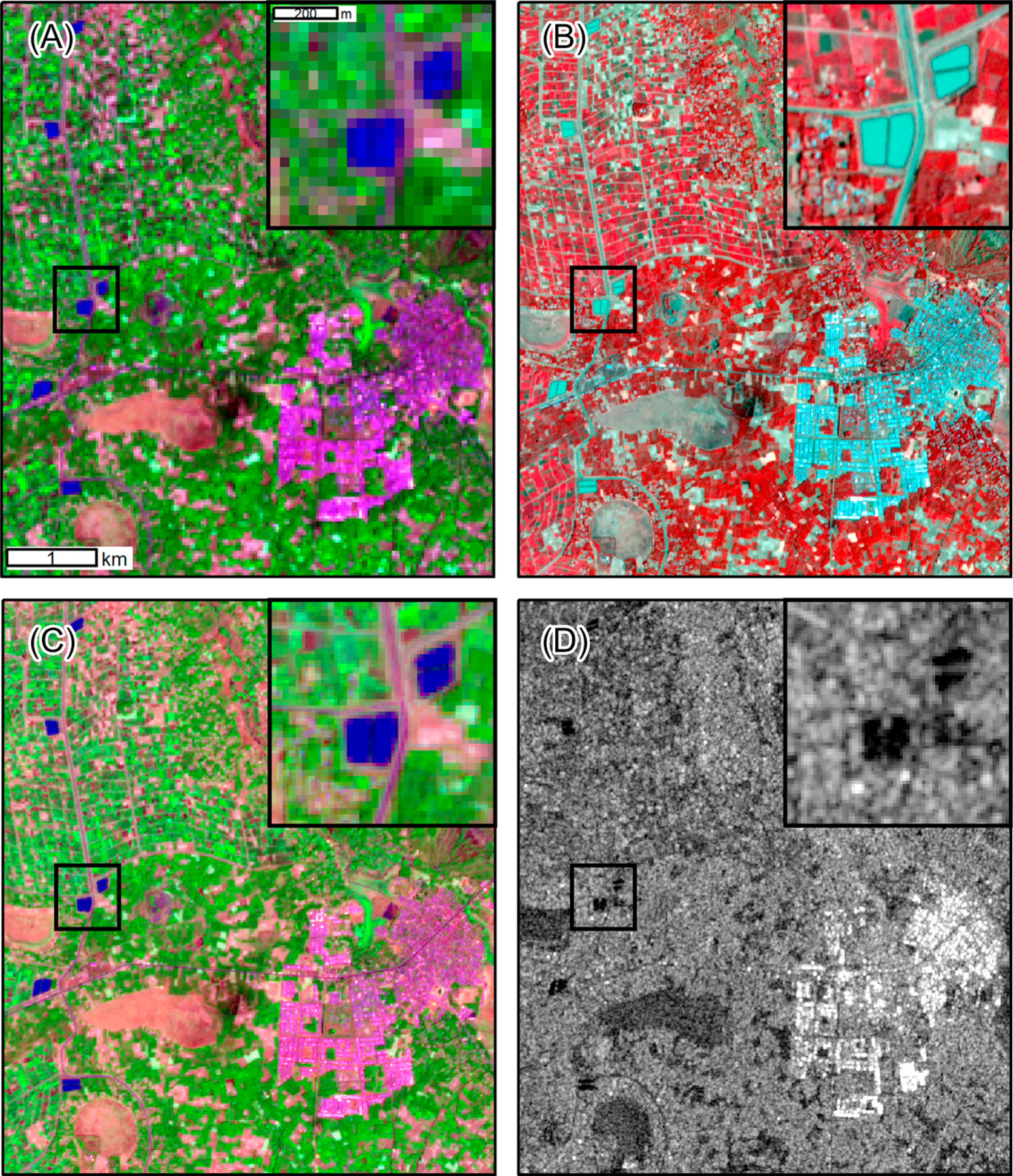
Figure 4. Satellite Images of a Landscape in the Mecha District of Ethiopia in March 2019.

There is irrigated agriculture in the northwest part of the maps and the town of Merawi is located in the southeast. The zoomed inset map (dark boxes) shows irrigation canals and water storage ponds. (A) Landsat 8 false-color composite (shortwave infrared band displayed as red, near-infrared band displayed as green, and green band displayed as blue). Vegetation appears green, impervious surfaces are pink and purple, wetlands are reddish-brown, and open water is dark blue. (B) PlanetScope false-color composite (near infrared band displayed as red, red band displayed as green, green band displayed as blue). Vegetation appears red, impervious surfaces are white and light blue, wetlands are gray, and open water is light blue. (C) Sentinel-2 false color composite. Band display and interpretation are the same as for Landsat. (D) Sentinel-1 synthetic aperture radar image displaying the strength of signal returned to the sensor. The brightest areas indicate strong returns from buildings. Darker areas indicate open water and wet areas that reflect the signal away from the sensor. The geographic coordinates of Merawi are 11.410 N, 37.154 E.
