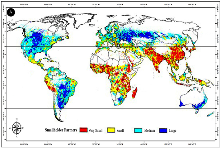
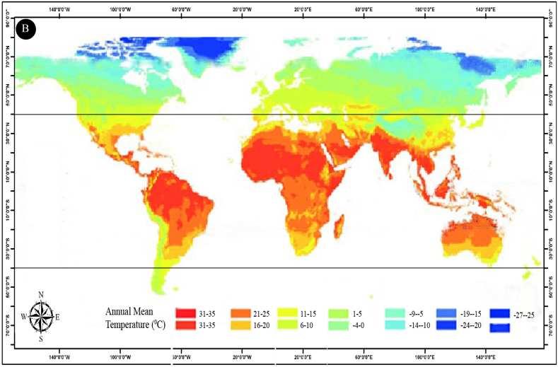
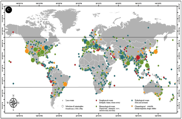
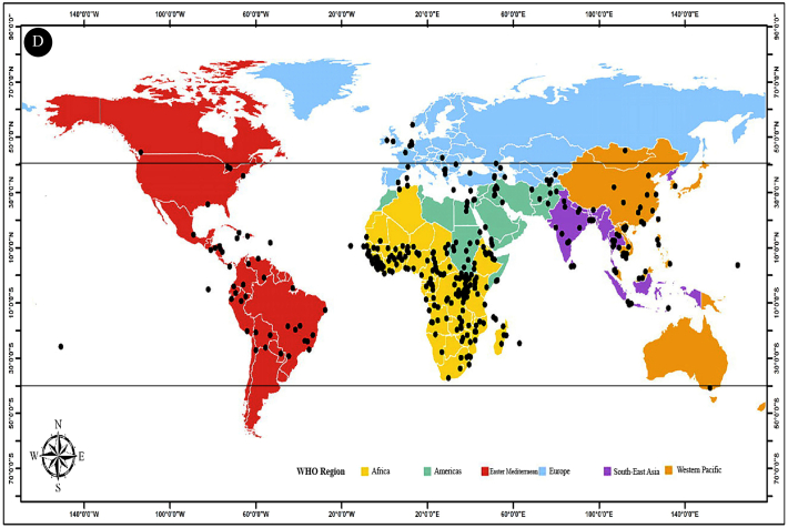
Fig. 2.
(A) Global distribution of farm field size (smallholder farmers, adapted and modified from [18]); (B) Global distribution of annual mean temperature by latitude (adapted and modified from [19] with permission); (C) Climate change-induced extreme weather events related to meteorological, hydrological, and climatological phenomena in 2014 (adapted and modified from [20] with permission); (D) Geographical distribution of emerging infectious diseases reported by WHO from 1996 to 2009 (adapted and modified from [21] with permission). Note: All the maps from (A) to (D) have been reconstructed by using ArcGIS. (B), (C), and (D) represent data from 2009 to 2014. Due to lack of availability of more recent data, these maps are considered baseline maps.


