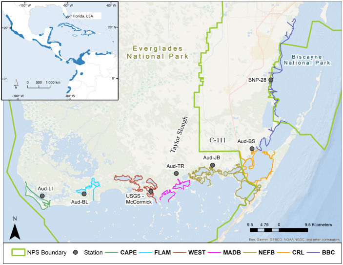
Fig 1. Study area of American crocodile (Crocodylus acutus) survey routes from Biscayne Bay Complex west to Cape Sable in South Florida, USA.
Survey routes are grouped by areas: BBC = North and South Biscayne, and Card Sound; CRL = Crocodile Lake National Wildlife Refuge, North Key Largo, Barnes Sound, and Manatee Bay; NEFB = NE Florida Bay from US1 to Alligator Bay (including Long, Little Blackwater and Blackwater Sounds, Joe Bay, Davis Cove, Deer Key and Alligator Bay); MADB = Little Madeira Bay, Taylor River, and Madeira Bay; WEST = West, Cuthbert, Long, Seven Palm, Middle, and Monroe Lakes, and Terrapin Bay; FLAM = Flamingo, Buttonwood and Homestead canals, Coot Bay, Mud and Bear Lakes; CAPE = Cape Sable beaches, East Cape Canal, Lake Ingraham and associated creeks. Representative hydrological monitoring stations for each area are indicated with a black circle.

