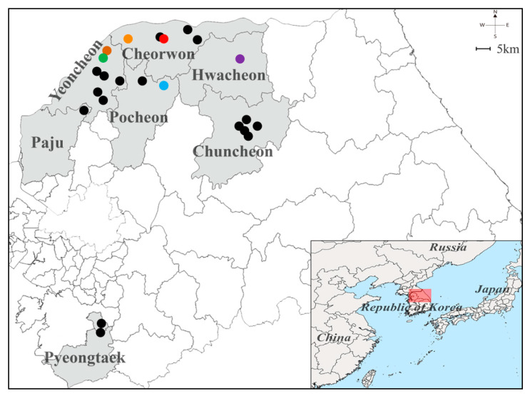
Figure 2.
Geographical location of the trapping sites of Hantaan virus (HTNV) collected from Gyeonggi and Gangwon Provinces, the Republic of Korea. The geographic map shows different trapping areas where small mammals were captured at Gyeonggi and Gangwon Provinces in 2019. The colored circles indicate the HTNV RNA positive sites: Pocheon, blue (Jangam-ri); Yeoncheon, green (Dosin-ri) and brown (Sang-ri); Cheorwon, orange (Gwanu-ri) and red (Dochang-ri); Hwacheon-gun, violet (Pungsan-ri). The black circles represent the locations where no HTNV RNA was detected: Paju (Jeogam-ri); Pocheon (Jail-ri); Yeoncheon (Hyunga-ri, Dongi-ri, Ohkye-ri, Yangwon-ri, and Bugok-ri); Cheorwon (Eupnae-ri, Munhye-ri, and Chungyang-ri); and Chuncheon (Gamjeong-ri, Sinchon-ri, Jinae-ri, Balsan-ri, and Yulmun-ri). A Quantum Geographical Information System (QGIS) 3.10 for Mac was used to create the map, which was modified in Adobe Illustrator CC 2019.

