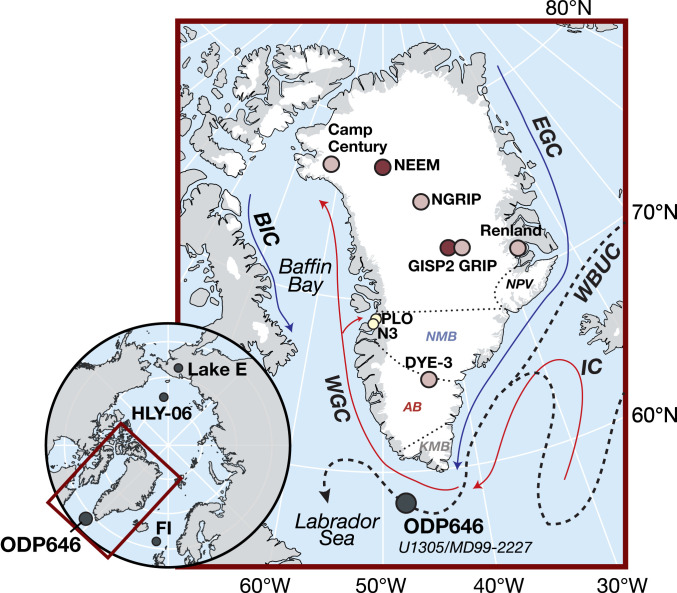
Fig. 1.
Map of study region. Location of Eirik Drift core sites (black point), including Ocean Drilling Program Site 646 used in this study. Dotted lines separate silt provenances as in Fig. 2H (5, 12). White is the modern glacier extent. Solid lines are the modern schematic surface ocean currents: the West Greenland Current (WGC), Baffin Island Current (BIC), and Irminger Current (IC). The dashed line is the Deep Western Boundary Undercurrent (WBUC). Points are the Greenland ice cores (27), with ice dated to peak (dark red) or late (light red) MIS5e (28–31) and Holocene δ2HC28 records (yellow) (17, 24). The inset map is of Lake El’Gygytgyn (Lake E) (9), Arctic Ocean core HLY-06 (10), and the Faroe Islands (FI) (25).

