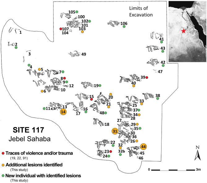
Figure 1.
Location of the Jebel Sahaba cemetery, Site 117, in the Nile Valley and map of the excavated area and burials (map following23, Image Courtesy British Museum Wendorf Archive, modified with Adobe Illustrator CS6, https://www.adobe.com/products/illustrator.html). Red dots: individuals exhibiting signs of violence and/or traumatic lesions19,20,91; orange dots: newly identified lesions in the latter individuals; green dots: individuals newly identified as showing signs of violence and/or traumatic lesions; large dots: individuals discussed in detail in the text. Satellite image: Google Maps, 2020. 21° 58′ 12.0" N 31° 22′ 12.0" E, elevation 21.9 M. [online] Available through: <https://www.google.com/maps/place/>.

