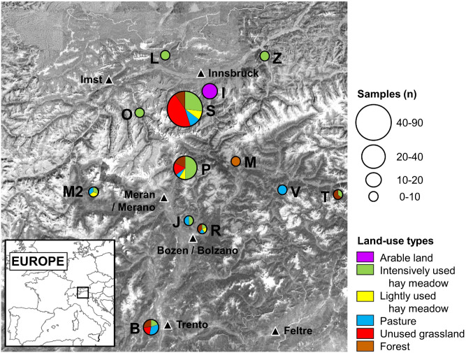
Figure 2.
Site, sample number and analyzed land-use types in the Eastern Alps. Study sites: B = Monte Bondone; I = Igls/Patsch; J = Jenesien; L = Leutasch; M = Mühlbach; M2 = Matsch; O = Ötz Valley; P = Passeier Valley; R = Ritten; S = Stubai Valley; T = Toblach; V = St. Vigil; and Z = Ziller Valley. The map was created using ArcGIS 10.2.2 (ESRI Inc.) and edited in Microsoft PowerPoint 365 MSO (Map data: Esri, DigitalGlobe, GeoEye, Earthstar Geographics, CNES/Airbus DS, USDA, USGS, AEX, Getmapping, Aerogrid, IGN, IGP, swisstopo, and the GIS User Community).

