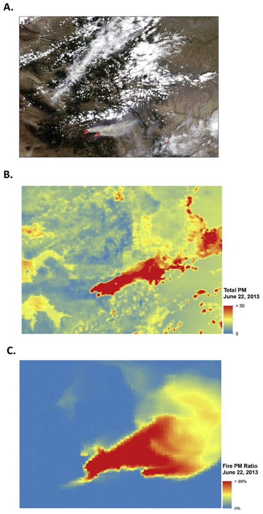
Fig. 5.

Satellite smoke plume, modeled total PM2.5 and smoke PM2.5 for west fork fire complex, June 22, 2013. Modeled data corresponds to visible smoke plume as shown in A-C. A) Satellite image from June 22, 2013 with active West Fork Complex Fire (NASA, 2013). B) Total PM2.5 for Colorado on June 22, 2013. C) Amount of PM2.5 attributed to fire on June 22, 2013.
