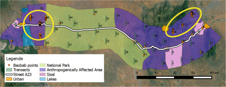
Fig. 2.
Map showing the locations of the baobab trees (orange points) found in the 49 surveyed transects along the Voi–Taveta road in Taita–Taveta County, Kenya. Each yellow circle marks areas of high baobab density (transects with ≥0.08 baobabs/ha); markings were based on transect counts. The circle on the right is named the ‘Taita cluster’, whereas the one on the left is named ‘Taveta cluster’. Map made on QGIS Valmiera 2.2 with a GoogleEarth background

