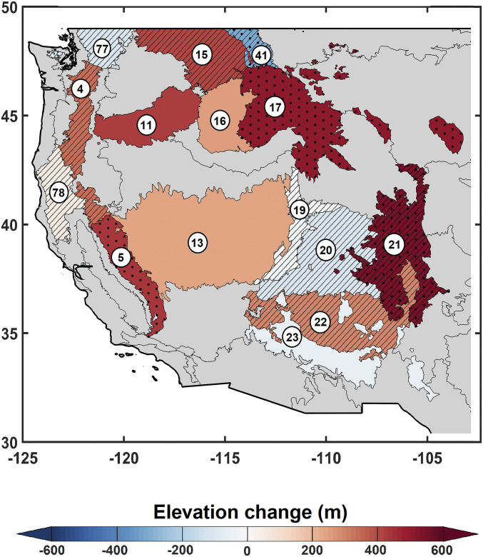
Fig. 1.
High-elevation fires are generally moving upslope across mountainous western United States. Changes in Z90 during 1984 to 2017 are presented. The dotted area represents statistically significant monotonic trend at the 5% level using the Mann–Kendall trend test. The hatched areas are associated with ecoregions with at least 10% length of record (4 y) excluded from the analysis due to absence of fire. The gray shaded ecoregions are not included in the analysis. The ecoregion names are as follows: 4: Cascades, 5: Sierra Nevada, 11: Blue Mountains, 13: Central Basin and Range, 15: Northern Rockies, 16: Idaho Batholith, 17: Middle Rockies, 19: Wasatch and Unita Mountains, 20: Colorado Plateaus, 21: Southern Rockies, 22: Arizona/New Mexico Plateau, 23: Arizona/New Mexico Mountains, 41: Canadian Rockies, 77: North Cascades, and 78: Klamath Mountains/California High North Coast Range.

