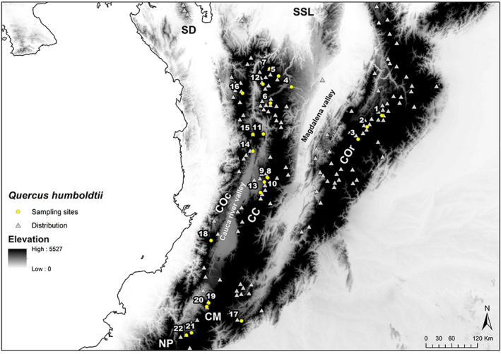
FIGURE 2.

Quercus humboldtii distribution is represented by occurrence records (gray triangles) and sampling locations included in this study (yellow circles). In the background, elevation is displayed in a grayscale where light colors correspond to lowlands and darker colors to highlands. COc, Cordillera Occidental; CC, Cordillera Central; COr, Cordillera Oriental; CM, Macizo Colombiano; SD, Serranía del Darién; SSL, Serranía de San Lucas; NP, Nudo de los Pastos
