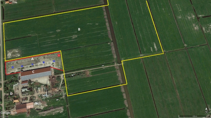
Figure 1.
Aerial view of the layer farm, with the free-range study area (A) directly connected to the poultry house (C), and the surrounding grass pastures (B) that formed the total surface of the free-range area (A + B). The red line marks the fence. The area within the yellow line (B) is the range of the laser during daylight laser beaming. The area within the red line (A) is the range of the laser during night laser beaming. The red star (upper right corner in area A) indicates the position of the laser. The blue stars in area A indicate the position of the wide-angle video-cameras. The farm house is indicated by D (source: Google Earth, 2021 Google).

