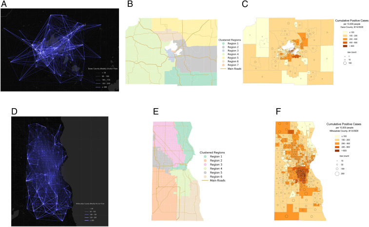
Fig. 1.
The spatial distributions of (A) human movement O-D flows between census tracts in Dane County, (B) Dane County spatial clustering results using the Walktrap network community detection method, (C) the raw cumulative confirmed COVID-19 cases and ratio of per 10,000 people at the census tract level in Dane County by August 14, 2020, (D) human movement O-D flows between census tracts in Milwaukee County, (E) Milwaukee County spatial clustering results using the Walktrap network community detection method, and (F) the raw cumulative confirmed COVID-19 cases and ratio of per 10,000 people at the census tract level in Milwaukee County by August 12, 2020. (COVID-19 confirmed cases data were retrieved from the Wisconsin Department of Health Services.)

