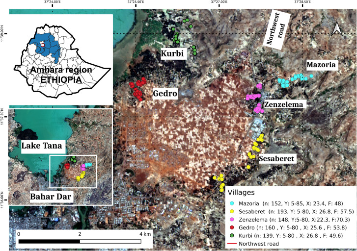
Fig 1. Study area in Amhara Region, Ethiopia.
The villages included in this study were Kurbi, Gedro, Mazoria, Sesaberet and Zenzelema, belonging to a rural district. The number of people (n) recruited per village as well as their age range in years (Y), average age (X) and distribution by sex (F = % female) are noted in the box on the right hand corner. Landsat-8 images, "Image courtesy of the U.S. Geological Survey", downloaded from the US Geological Survey server (USGS, https://www.usgs.gov) using Earth Explorer platform (https://earthexplorer.usgs.gov). The geographical location for Landsat-8 is: Path 170, Row 52. DATE_ACQUIRED = 2016-03-10.

