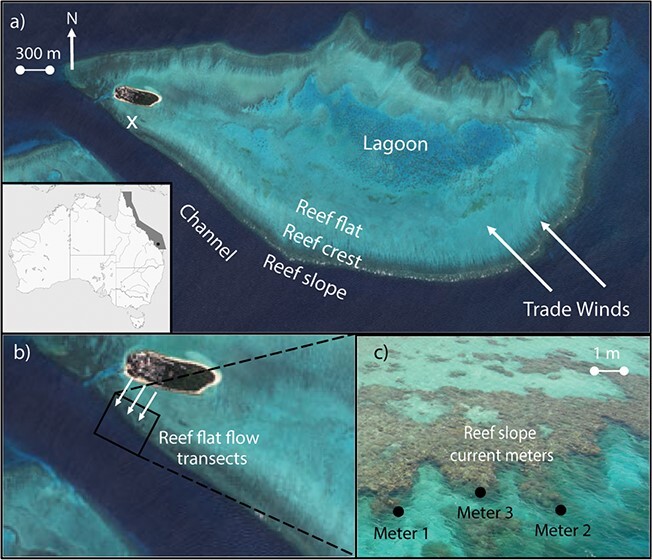
Figure 1.

(a) Heron Island (23°26.1871″S, 151°54.3023″E) is situated on the Southern GBR. The position of Heron Island is marked by a black circle. Different reef zones are shown. A white x marks coral collection from reef flat. (b) Reef flat flow transects. Flow speed was measured along three transects at five points spaced by 10 m using an ADV held at the average height of the surrounding coral benthos (~0.2 m). (c) Three current metres were deployed at Coral Gardens (23°26.698″S, 151°54.533″E) adjacent to where the reef flat measurements of flow velocity were measured, and corals were collected. Metres 1 and 2 were placed on exposed areas of the reef, whereas flow metre 3 was placed in a more sheltered position. Images provided by DigitalGlobe.
