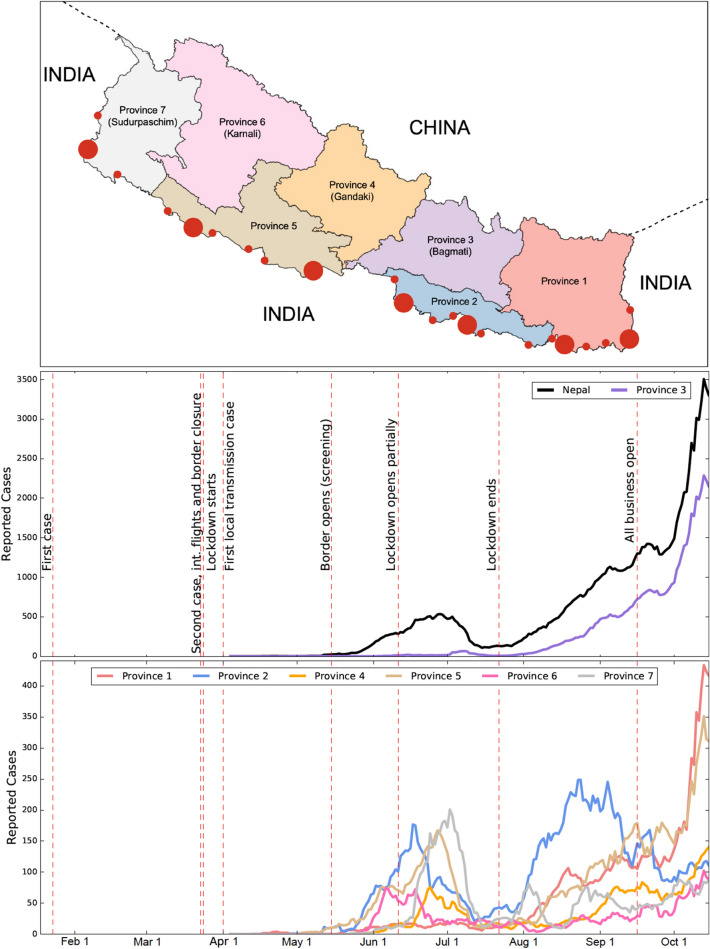
Figure 1.
(Top Panel) A map of Nepal showing its seven provinces and entry-points (filled red circles) along the border with India. To create the map, the data (shapefile format) was obtained from the official webpage (http://dos.gov.np) of the government of Nepal (Accessed on April 23, 2021)45. The map was then created using GeoPandas Verson 0.8.1 (https://geopandas.org/index.html)45 module in Python programming. The large-sized circles indicate the major entry points: Kanchanpur, Nepalganj, Siddharthanagar, Birgunj, Jaleshwar, Biratnagar, and Kakarbhitta (listed from the left to right). The small-sized circles indicate the minor entry points (official border crossings)46. (Middle and Bottom Panels) The number of reported cases of COVID-19 in Nepal and in its provinces from January 23, 2020 to October 15, 2020. Because of the high magnitude of the cases of Province 3, the daily new cases data are shown in the same graph (middle panel) for Province 3 and the whole country, while the daily new cases data for the remaining six provinces are shown together in a single graph (bottom panel). The vertical red dashed lines represent the dates corresponding to the policy changes by the government.

