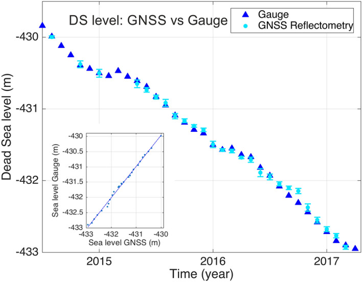
Figure 2.

Blue triangles represent the DS lake level from 11th June 2014 to 29th March 2017, in meters below mean sea level, data provided by the Hydrological Service and Water Authority, Israel (Gauge near Massada). The DS lake level determined from GNSS reflectometry observations (Fig. 1, Beach stations) is shown in light blue (dots), with error bars. The standard error of the GNSS measurements is ± 2.7 cm. (Insert) The correlation coefficient between the two time series is 0.99, indicating the high accuracy of the GNSS observations.
