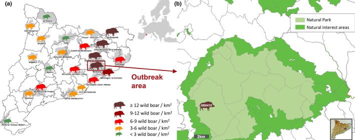
Figure 1.

Study area. (a) Map of Catalonia (North‐eastern Spain) that shows the local densities of wild boars estimated for the hunting season 2018–19 (DARP 2019). The brown rectangle shows the outbreak area (14 wild boar/km2). (b) The studied outbreak area includes the Montseny Natural Park (light green) and surrounding areas. The different municipalities are delimited by dotted lines. The silhouette shows the approximate localization of the first detected wild boar with TB lesions and Mycobacterium caprae isolation (the spoligotype profile is indicated within the silhouette) [Colour figure can be viewed at wileyonlinelibrary.com]
