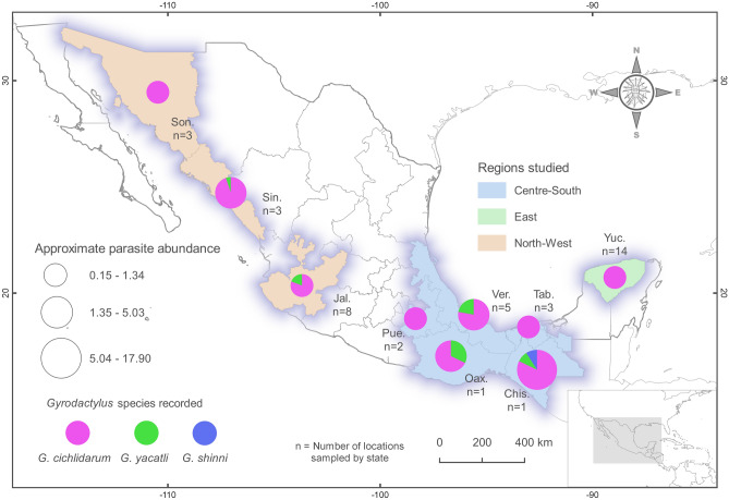
Figure 1.
Map of Mexico, showing the distribution of Gyrodactylus cichlidarum, G. yacatli and G. shinni n. sp. and the localities of farms where “tilapia” and native fish were sampled. State names are as follows: Son: Sonora; Sin: Sinaloa; Jal: Jalisco; Pue: Puebla; Ver: Veracruz; Tab: Tabasco; Oax: Oaxaca; Chis: Chiapas; Yuc: Yucatán. We used QGIS version 3.6.2 (http://www.qgis.org) to generate the map. The layers of political division of Mexico were obtained from the CONABIO geoportal (http://www.conabio.gob.mx/informacion/gis/).

