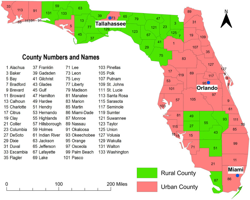
Fig 1. Map of Florida showing geographic distribution of urban and rural counties.
Figure was created using the Free and Open Source Geographic Information System (GIS) software, QGIS. The basemaps used to create the maps were downloaded from the US Census Bureau Website: https://www.census.gov/geographies/mapping-files/time-series/geo/tiger-line-file.2010.html. The source of the data displayed in the map is Florida Department of Health. Data are available at: http://www.floridahealth.gov/programs-and-services/community-health/rural-health/_documents/rual-counties-2000-2010.pdf.

