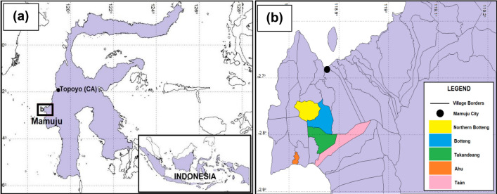
Figure 6.
Location maps. (a) Sulawesi Island, including Mamuju region which was the study HNBRA and Topoyo Village which was the study NBRA. (b) Villages of the study in Mamuju region. HNBRA refer to the high natural background radiation area and control area (CA) refers to the normal background radiation area (NBRA) or control area. Maps were created in MAPINFO PROFESSIONAL version 10.5 (https://www.precisely.com/product/precisely-mapinfo/mapinfo-pro) using map data derived from the National Mapping Agency of Indonesia (https://tanahair.indonesia.go.id/portal-web).

