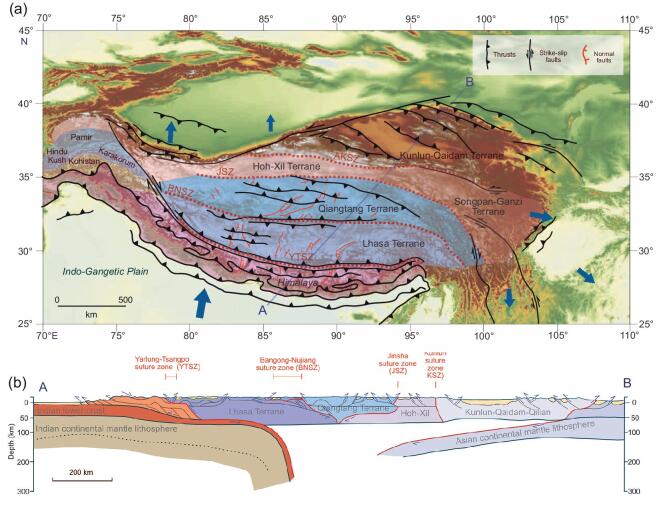
Figure 6.
(a) Map of the Tibetan region showing the principal accreted terranes, thrusts, strike-slip and normal faults. The sizes of the blue arrows represent the relative motion today as measured by GPS [10]. (b) Modern topographic profile along the transect A–B in (a). (c) Hypothesized cross-section along the transect A–B in (a) simplified from [1].

