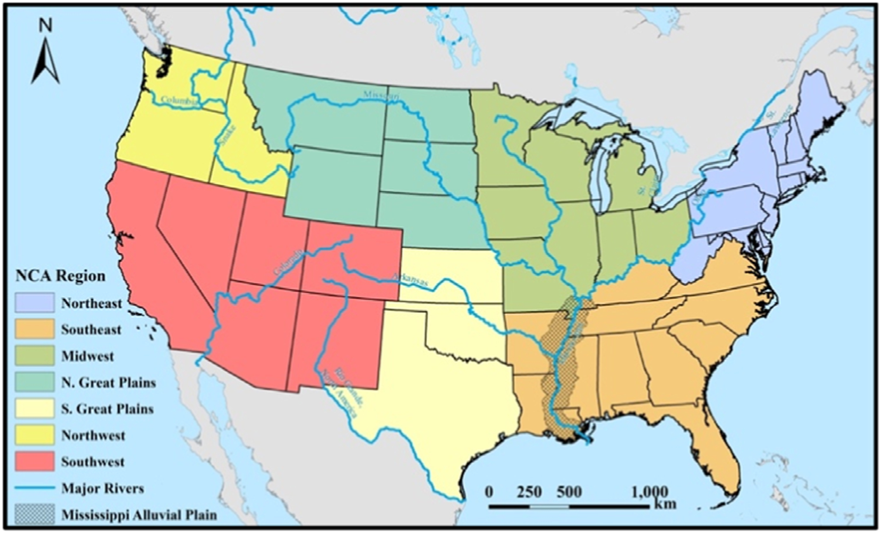
Figure 1.

Map of the contiguous United States (CONUS) with major rivers, divided into National Climate Assessment (NCA) regions. Cross-hatching indicates the Mississippi Alluvial Plain in the Southeast (data from the U.S. Environmental Protection Agency [33]). Background mapping and river data provided by ArcWorld and ArcWorld Supplement from Esri®.
