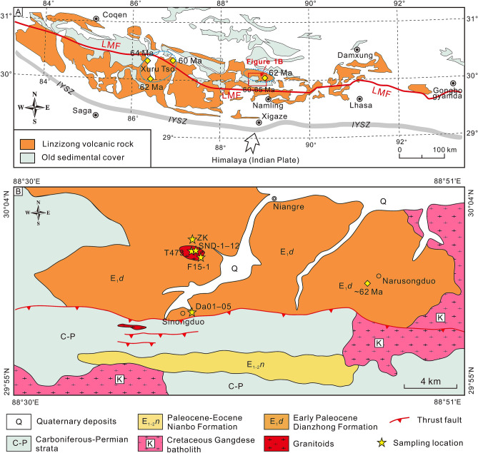
Figure 2.
(A) Simplified tectonic framework of the southern margin of the Lhasa block showing the location of the study area. (B) Regional geological map showing the study area, modified from the China Geological Survey (www.cgs.gov.cn) based on our field observations. The maps were generated by Zongyao Yang, using CorelDRAW X8 version 18.0.0.448. Yellow diamonds represent literature data of Paleocene S-type magma9–12. Blue dashed circles represent the approximate extent of the s-type granitic rocks. LMF Luobadui–Milashan Fault.

