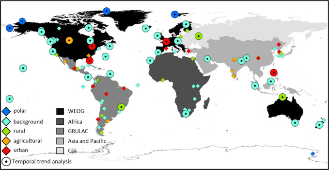
Figure 1.
Map showing all 111 GAPS sites operated during 2005–2014, differentiated by usage and remoteness as polar, background, rural, agricultural and urban. 55 sites are currently still operational. The 40 sites with data available for 5–10 years are indicated (circle). The five UNEP working group regions are indicated using shading. WEOG – Western Europe and other Groups region; GRULAC – Group of Latin American and Caribbean Countries region, CEE – Central and Eastern Europe region, Africa and Asia and Pacific Group. Additional site information is presented in Figure S2 and the Supporting Information Excel file.

