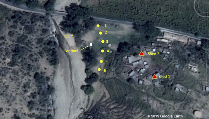
Figure 1. Map of the study area © 2019 Google Image Landsat/Copernicus.
The village of Adi Boskal, Anseba Zoba, Eritrea, showing the location of the outdoor trapping sites (yellow circles with numbers representing catch number), the sentinel tent-trap (white square) and the two sheds used for the collection of resting insects (red triangles). Also shown is the location where the exit collections took place. © 2019 Google Image Landsat/Copernicus.

