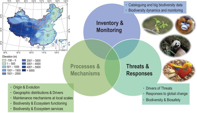
Figure 2.
Research highlights of China's biodiversity science in three main areas, including 10 key research topics. The map on the left shows the elevation ranges in China. The lines with different colours in the map divide the country into eight vegetation regions [19]:  cold-temperate deciduous needle-leaved forests;
  temperate mixed-needle and broad-leaved forests;
  warm-temperate deciduous broad-leaved forests;
  subtropical evergreen broad-leaved forests;
  tropical monsoon rain forests and rain forests;
  temperate grassland;
  temperate desert;
  Qinghai-Tibetan Plateau alpine vegetation. Digital elevational model (DEM) data at 10 arcmin spatial resolution were downloaded from WorldClim [20]. The four pictures present the iconic species Ginkgo biloba (copyright Yunpeng Zhao), Rhinopithecus roxellanae (copyright Sheng Li), Ailuropoda melanoleuca (copyright Yibo Hu) and Chrysolophus pictus (copyright Sheng Li). The map of China is from http://bzdt.ch.mnr.gov.cn/.

