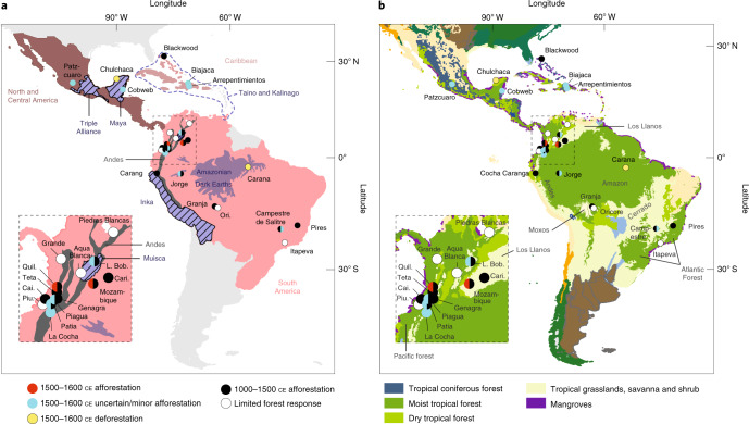
Fig. 2. Locations of Neotropical pollen records.
a,b, Locations of the Neotropical pollen records (points) included in this analysis shown relative to major pre-Iberian and Iberian era colonial geopolitical units (a) and ecoregions (b)36. In a, the red shading corresponds to the tropical Spanish Americas, whereas the blue shading and font represent selected pre-Iberian cultural zones. In b, any shading not defined in the key represents temperate/xeric biomes. The colour of each point corresponds to the assessed afforestation response of each record before (1000–1500 ce) and after (1500–1600 ce) Iberian contact. Record names are shown in black. Ecoregion names are shown in grey. In both panels, the insets show a magnified view of the Andes area highlighted by a dashed box in the main map. Terrestrial ecoregion data in b partially reproduced with permission from WWF.

