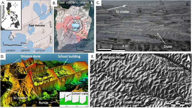
Figure 2.
Dunes of TVI. (A) General location of Taal Volcano Island. The area within the dashed lines is the Macolod Corridor, a 40-km-wide rift zone65. (B) Distribution of the 2020 base surge dunes. Circles refer to upper slope, middle slope, and lower slope boundaries. Areas with dune forms identified through satellite imagery are in red. Field validation was done in the southeast flank (yellow portion of map). K3 and ASTI (“Philippine Copyright 2021 by DOST-ASTI”, includes material (c) KARI 2021, Distribution (SI Imaging Services, Republic of Korea), all rights reserved. (C) Photograph of the dune field. (D) Digital Surface Model of school overwhelmed by base surges. Sinuous dunes and runup of the base surge also occur inside the classrooms. (E) Plan view image of dunes showing elongate and lunate dunes. Bifurcation of dunes is also shown.

