
FIGURE 1.
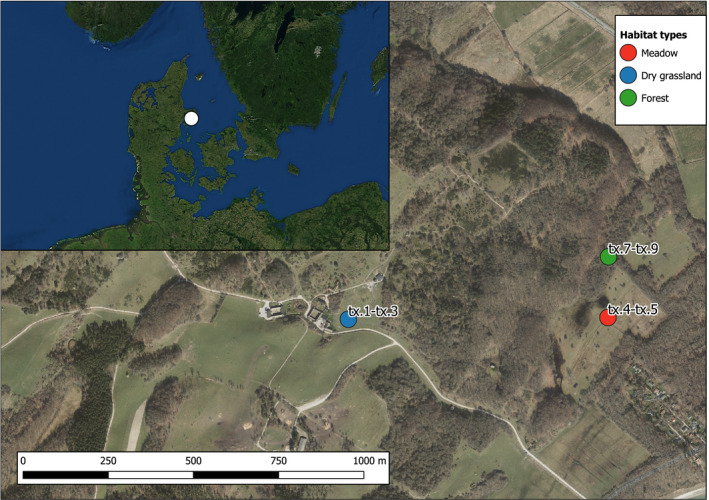
Map of sampling sites in Mols Bjerge with inset overview map of Denmark. Sample names are indicated for each site. Map data: (main map) Agency for Data Supply and Efficiency. GeoDanmark Ortofoto. 2019, (inset map) ESRI. World Imagery 2013
Official websites use .gov
A
.gov website belongs to an official
government organization in the United States.
Secure .gov websites use HTTPS
A lock (
) or https:// means you've safely
connected to the .gov website. Share sensitive
information only on official, secure websites.
Map of sampling sites in Mols Bjerge with inset overview map of Denmark. Sample names are indicated for each site. Map data: (main map) Agency for Data Supply and Efficiency. GeoDanmark Ortofoto. 2019, (inset map) ESRI. World Imagery 2013