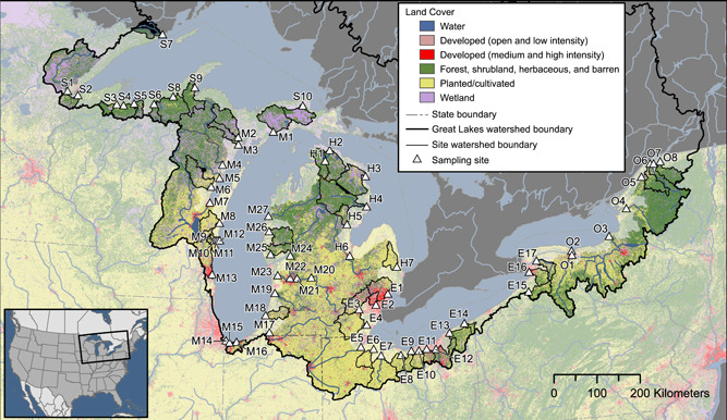
Figure 1.

Map of sample sites and associated land cover. Identification of site codes is presented in Figure 4 and in Supplemental Data, Table SI‐1. Map base layers derived from Department of Agriculture and Agri‐Food Canada 2020; Homer et al. 2015; Instituto Nacional de Estadística Geografia e Informática et al. 2006a, 2006b; Steeves and Nebert 1994; US Department of Agriculture–Natural Resources Conservation Service et al. 2009.
