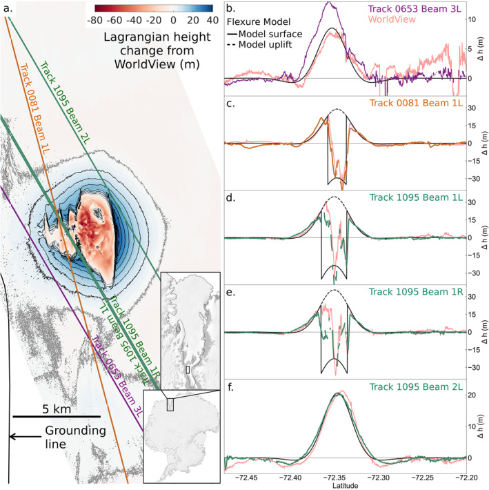
Figure 2.

Elevation changes and estimation of unloading by the drainage event. (a) Elevation changes for the doline and surrounding ice shelf from Lagrangian differencing of WorldView digital elevation maps (DEMs) (March 26, 2018 and December 20, 2019). Contours are shown for positive changes: 5 m interval, zero contour in grey, overlaid with locations of ICESat‐2 ground tracks (GTs). (b–f) ATL06 elevation difference profiles along ICESat‐2 GTs (from west to east), with corresponding profiles from the WorldView DEM difference and flexural modeling. Imagery ©️ 2020 DigitalGlobe, Inc.
