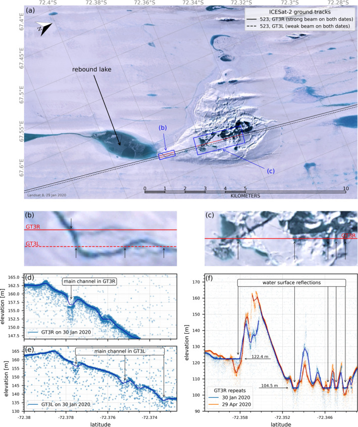
Figure 3.

First melt season after doline formation (2019/2020). (a) Landsat 8 image January 29, 2020 #126/111; ICESat‐2 Tracks 0523 GT3L and GT3R are shown; (b and c) zooms of Landsat 8 image; ICESat‐2 ATL03 and ATL06 data (d and e) for Track 0523 GT3L and GT3R across a drainage channel (at −72.378°) incised by meltwater flow from the rebound lake to the doline; (f) for Track 0523 GT3R across the doline in January and April 2020 showing the structure of the collapsed ice lid and meltwater surfaces at 122.4 and 104.5 m; the April track is displaced to align major features with the January profile.
