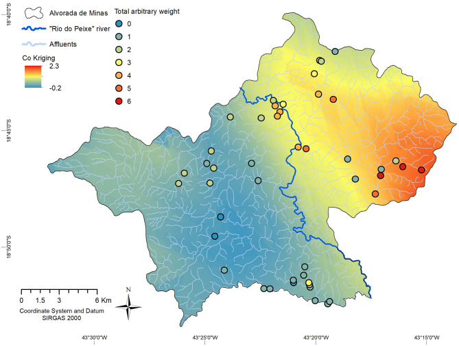
Figure 6.
Risk map for transmission of schistosomiasis, estimated by Cokriging with total arbitrary weight of environmental and human epidemiological data, in the Municipality of Alvorada de Minas, Minas Gerais, Brazil. Relative risk is indicated by a graduated color map, with red areas corresponding to high risk and dark blue areas with absent risk of infection.

